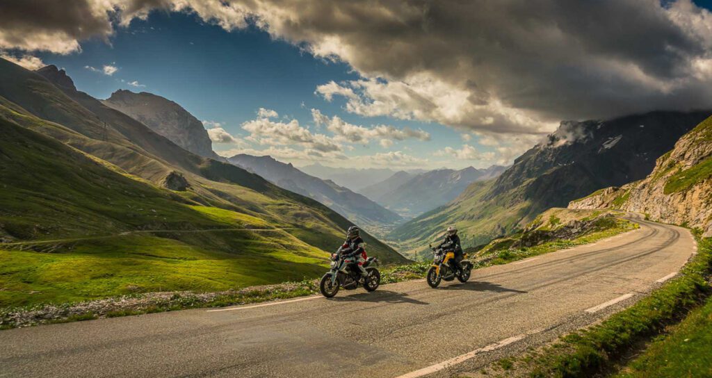
The Col du Galibier – we visited this French giant in summer 2022. An impressive landscape experience. A motorcycle story by Moppetprosa – photos by Uli (moppetfoto.de), text by me, special guest: Julia from maedchenmotorrad.de.

This story about the Col du Galibier appeared in the „Passportrait“ series in MOTORRAD, Europe’s largest motorbike magazine, issue 10.2023 (April). The Passportrait is a collaboration between Uli from www.moppetfoto.de and myself.
Before you read, please note: this post was translated with the help of Deepl.
If you find any errors – please have fun first and then give me a hint.
It is the fifth highest Alpine pass, the second highest pass on the Route des Grandes Alpes after the Col de l’Iseran and a classic of the Tour de France: the Col du Galibier, 2642 metre high. It runs north-south and not only separates the two départements of Savoie (N) and Hautes-Alpes (S), but also acts as a weather divide between the wetter northern Alpine climate and the drier Mediterranean climate.
The historic mule track was extended in 1876, making it the first motorable pass road between the Briançonnais and the Maurienne. A short time later, a 365-metre-long crest tunnel was added around 100 metres below the Col in order to bypass the difficult road section at the summit.
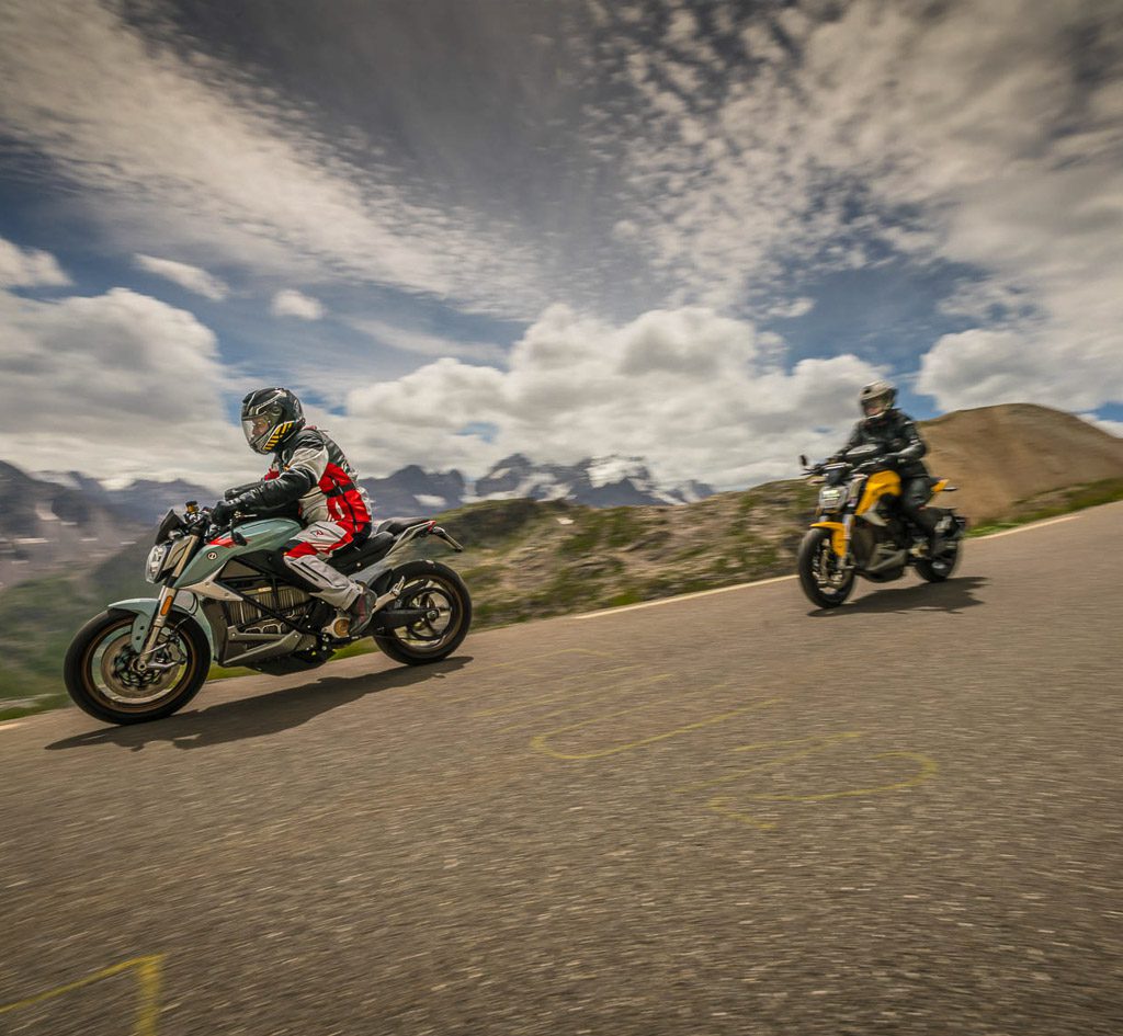
Col du Galibier: a compulsory pass for motorcyclists
Photo: www.moppetfoto.de
In the 1970s, the dilapidated tunnel forced the reactivation of the original road, which was impressively steep and narrow on both ramps. Part of the former crossing was removed and a plateau with parking facilities was created. This reduced the height of the pass by 16 metres. The lunar landscape in the upper section is fascinating, the panorama of the surrounding Alpine scenery is magnificent – in the north, Mont Blanc can be seen on a clear day, while the southernmost four-thousand-metre peak in the Alps, the Barre des Écrins, rises into the sky in the south.
The 17 km long northern ramp starts in the mountain and ski village of Valloire, which in turn can only be reached via the Col du Télégraphe (1566 m). The 8 km long southern ramp is preceded by the 2025 m high Col du Lautaret. From there, the D902, which cuts diagonally through the mountainside up to the Col du Galibier, is already clearly recognisable. It initially climbs in gentle curves and is greeted by the last trees of the “Jardin du Lautaret”, a botanical garden, before yellow-flowering mullein plants become the largest and at some point the only plants along the way.
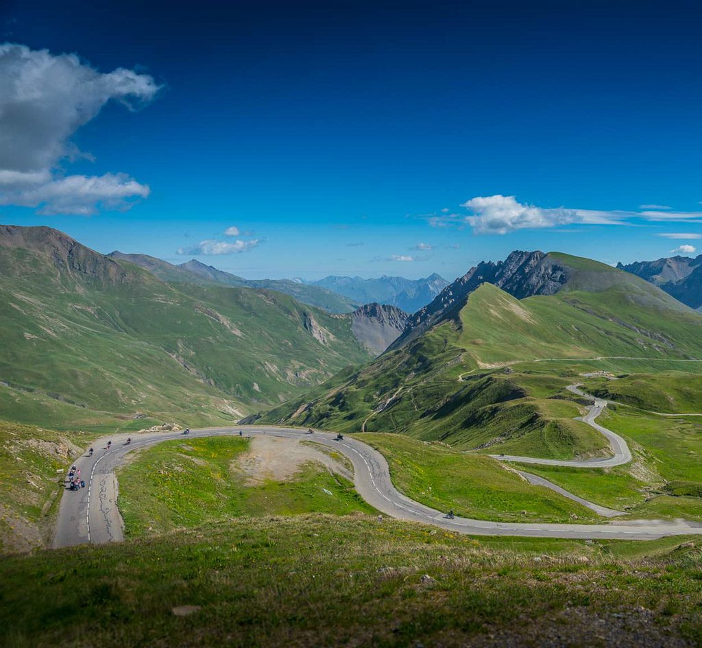
A course made for motorcyclists
Photo: www.moppetfoto.de
Due to its altitude, the Galibier is only open for a few months of the year, but then experiences a veritable rush on two and four wheels, whether motorised or powered by burning muscles. They are all drawn to the Col: Cyclists and motorcyclists and dedicated sports car drivers. French moped riders don’t miss the opportunity. So there is a constant photo rush at the border stone.
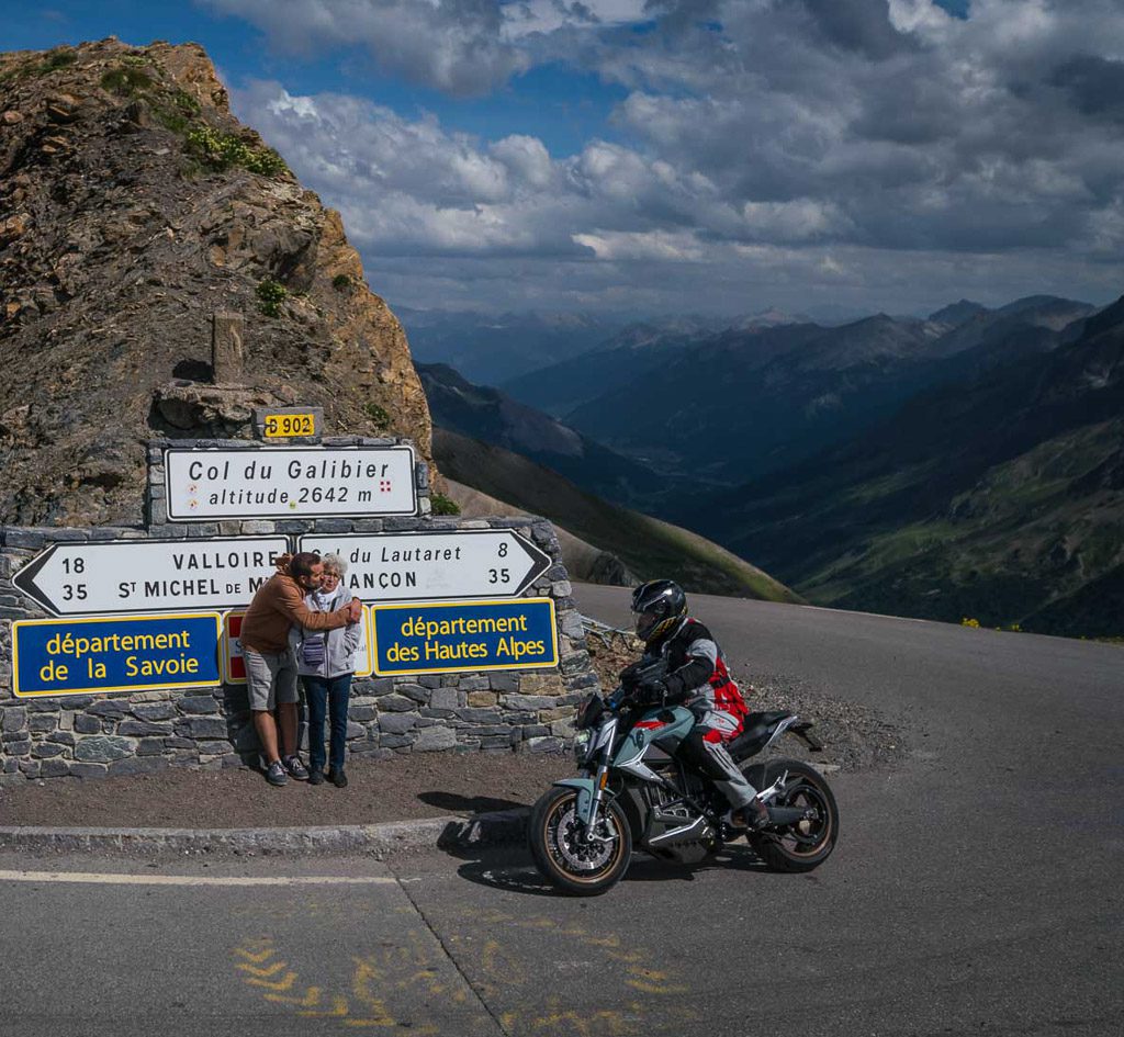
Classic picture: The pass sign on the Col du Galibier
Photo: www.moppetfoto.de
The D902 is forced into an entertaining course on its way over the Galibier. The road is bumpy despite a lot of tarmac work, but an appropriate speed allows the view over the wonderful mountains of the Massif des Cerces, the eponymous Gran Galibier and the glistening glacier mantle of the 3983 m high La Meije.
Numerous belvédères, a charming term for roughly gravelled passing places that are carelessly thrown at the side of the road, invite you to pause. From the valley, lush green vegetation stretches far across the slopes of the Gran Galibier. Through the visor, which is slightly misted up in the cold of the morning, it resembles densely woven wool – as if the giant rock is trying to protect itself from the cold of the night.
Horizontally stacked layers of sediment with sharp edges alternate with needles of stone jutting into the sky. The high alpine weather constantly tears massive blocks of stone to pieces, covers the landscape with coarse gravel and finally grinds it into orange-brown sand.
Humans and their roads are at a disadvantage here. All that remains for them is the path through old crevices and stone walls standing one behind the other. There are no retaining walls or road safety barriers – where the tarmac ends, either bare rock begins or the abyss opens up.
The gap that man has left in the mountain at 2556 metres above sea level, the crest tunnel at Beau Refuge, causes a disturbing feeling. A few kilometres from the Col du Lautaret, after an impressive swing through a wildly unspoilt landscape and along deep trenches, this dead straight hole in the rock, illuminated by bright blue LEDs, is confusing. Even the many grey-furred marmots whistle against this single-lane, popular concert hall for powerful motorcycles without success.
Although the tunnel with the highest traffic lights in Europe makes the pass easier, it also makes it less eventful, as the last kilometre up to the famous boundary stone in the middle of a hairpin bend is both a thrill and an exciting highlight. We experience riding on the edge: the road, which has varying gradients but always climbs steeply and becomes very narrow at the top, disappears into the blue of the open sky. Nothing hinders the view into the infinite or into the depths. What gives those who are afraid of heights a strong adrenaline rush also ensures fascinating views towards Briançon and the sea of peaks of the Queyras Nature Park.
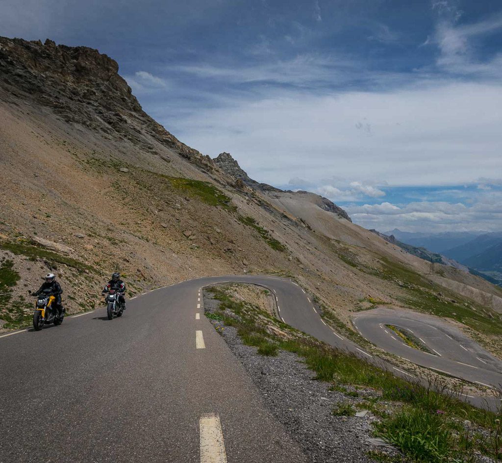
French dream road: grippy, winding, without barriers
Photo: www.moppetfoto.de
On the way to Valloire, the sun-drenched and heated southern slopes turn a dead grey, faded Tour de France paintings on the asphalt fight against it in vain. Piles of rubble push themselves into the depths and prevent any sprouting of vegetation. In contrast, the shady northern slopes are covered in lush greenery, interrupted by hiking trails that disappear into the high mountains. This is where a large proportion of the clouds rolling in from the north rain down, their water producing a vegetation that grows to well over 2500 metres above sea level – a paradise for huge herds of cattle and olfactorily challenging flocks of sheep and the basis for the region’s incomparable cheese.
Conversely, this precipitation causes deep scars in the mountain when the soaked ground loses its grip. Rusting metal railings border small bridges, under which narrow threads of water run down into the valley. During storms, these are likely to swell into raging torrents – it is not without reason that the iron appears in bizarrely twisted shapes.
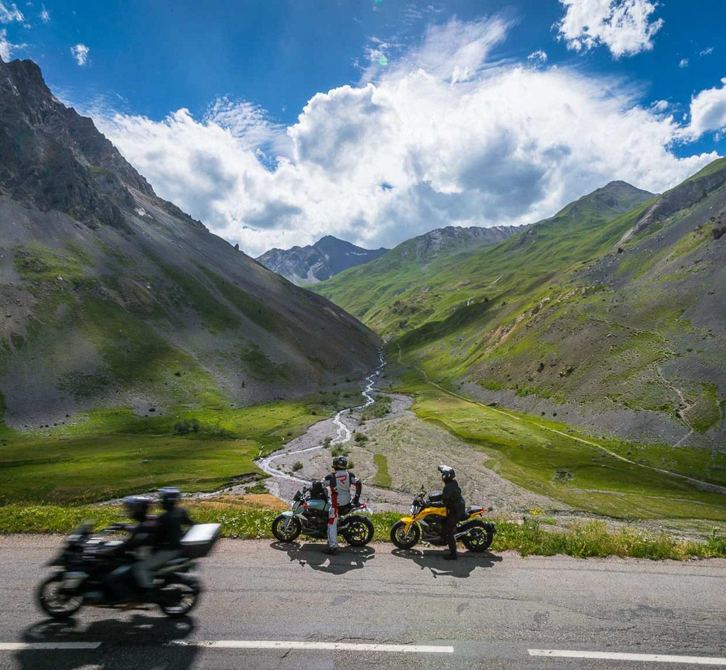
Magical views. That’s the Col du Galibier
Photo: www.moppetfoto.de
The D902 makes its way through this monumental mountain arena, winding around monoliths and bizarrely fractured boulders. Eternal sculptures in yellow, grey and reddish hues captivate the eye. It’s always worth taking a break from the spa dance to indulge in this natural wonder. Creatively and uninhibitedly distributed bitumen only disturbs the ride into the valley a little, as the Galibier north ramp also offers unexpectedly good grip. Orientation markings are extremely sparse – and here, too, a little courage is sometimes required to tackle the unsecured stretch at an angle.
After crossing the Pont de la Valloirette at just under 2000 metres above sea level, the D902 is relatively flat and unspectacular compared to the previous route, running alongside the Valloire stream. There is never a shortage of breathtaking scenery here either.
Valloire, the southernmost municipality in the Savoie département, is reached quickly. The winter sports infrastructure at the entrance to the village is nothing but disquisting, but the four-kilometre ascent to the Col du Télégraphe – also part of the fascinating Route des Grandes Alpes – follows at the end of the village.
Passportrait Col du Galibier: Thank-Yous, High-Fives & Links
- Rukka Motorsport
On the ride to and over the Col du Galibier, my Rukka textile suit and gloves served me well - SW-Motech
On this tour I was accompanied by the spacious Pro Rearbag from SW-Motech. This allowed me to transport a complete second rider’s kit on my Harley, including photographic equipment and food – great! - Nolangroup Deutschland
The ingenious X-lite X-1005 Ultra Carbon has proven itself once again: Top helmet, on the ride and for photography - Refuge du Galibier
Merci beaucoup pour votre hospitalité ! - Comité Régional de Tourisme Provence-Alpes-Côte d’Azur
Un grand merci pour votre précieux soutien !
Perfectly matching:

Let’s climb the Stelvio together!

Stelvio – Count from 1 to 10!
Have fun looking at them!

Magical Moments

Dream Roads: The Gavia Pass (2621 m)

Dream Roads: The Susten Pass (2224 m)
Unimaginable?